
Stormy Weather Headed to Georgia and South Carolina
Stormy weather is headed to Georgia and South Carolina this afternoon and into Thursday, according to the National Weather Service.
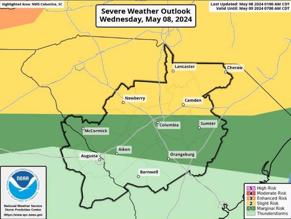
In South Carolina, the Aiken, Orangeburg, McCormick, Columbia and Sumter areas are expected to feel the greatest impact from the storms this afternoon through Thursday morning.
Wind gusts of 60-70 mph are possible, along with severe thunderstorms that could produce hail. Tornadoes are also a possibility in some areas of the state.
The National Weather Service says severe weather is even more likely Thursday in areas that include Augusta, Aiken, Barnwell, McCormick and Orangeburg.
“Powerful winds and tornadoes could cause considerable damage to trees and branches, in addition to mobile homes, roofs and outbuildings,” said the National Weather Service.
Severe Weather Expected in Georgia
Stormy weather with rain and a few thunderstorms could develop in the Augusta area overnight and into Thursday morning. The biggest threat of severe weather in this area is Thursday morning, when the potential exists for severe storms that could include large hail, damaging winds, possible flooding and even a tornado.
The National Weather Service says areas in the CSRA that should be on the lookout for severe weather include Columbia, Richmond, Lincoln, McDuffie and Burke Counties in Georgia, and Aiken, Barnwell, Bamberg, Edgefield, McCormick and Saluda Counties in South Carolina.
What’s the Difference Between a Tornado Watch and a Tornado Warning
- Tornado Watch: Means conditions are favorable for the severe weather event in or near the watch area. When a watch is announced, stay alert and be ready to cover if necessary
- Tornado Warning: Means a tornado has been sighted or indicated by weather radar. There is imminent danger to life and property. Move to an interior room on the lowest floor of a sturdy building. Avoid windows. If in a mobile home, a vehicle, or outdoors, move to the closest substantial shelter and protect yourself from flying debris.
